Alyssa Schnugg
News editor

A tropical depression or tropical storm is expected to form later today or tonight while the system moves northwestward over the northwestern Caribbean Sea.
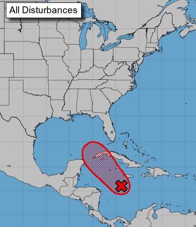
The system is expected to continue moving northwestward toward the central or northwestern U.S. Gulf coast, potentially bringing dangerous impacts from storm surge, wind, and heavy rainfall along portions of the northern Gulf Coast from the Florida Panhandle to the upper Texas coast, with the greatest risk along the coast of Louisiana.
The storm will most likely hit the coast late Sunday or early Monday.
However, uncertainty in the system’s exact track and intensity remains large since the low is just beginning to form, the National Hurricane Center reported this morning.
The chance for the system to form into a depression or tropical storm in the next 48 hours is at 90 percent.
If the system develops into a tropical storm, it will be known as Tropical Storm Ida.
If the storm makes landfall on Sunday, it will hit the coast on the 16th anniversary of when Hurricane Katrina made landfall as a category 4 hurricane at Plaquemines Parish, Louisiana.
This is a developing story. Hotty Toddy News will continue to watch the progression of the storm and post updates as they become available.