By Alyssa Schnugg
News editor
alyssa.schnugg@hottytoddy.com
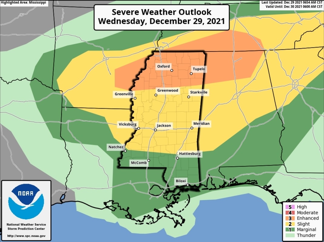
Most of the Mid-South, including Lafayette County, has been upgraded to an Enhanced Risk for severe weather later today and into the evening hours.
On a 0-5 scale used by the National Weather Service to assess risk for severe weather – with 0 being no severe storms expected and 5 being a High risk, Lafayette County is now a 3, or Enhanced Risk.
The primary threats this afternoon are damaging winds and heavy rain. Secondary threats include brief tornadoes and hail.
Scattered supercells are possible early today, with a better chance late this afternoon or early evening.
While it’s been raining in Oxford most of the morning, thunderstorms are expected to arrive around 2 p.m. and continue through the night until about midnight.
The storms are expected to end by early Thursday morning.
Hotty Toddy News will provide updates on any weather watches or warnings issued on its Facebook and Twitter pages.