
By Alyssa Schnugg
News editor
alyssa.schnugg@hottytoddy.com

Hold onto your hats, folks. It’s going to get windy.
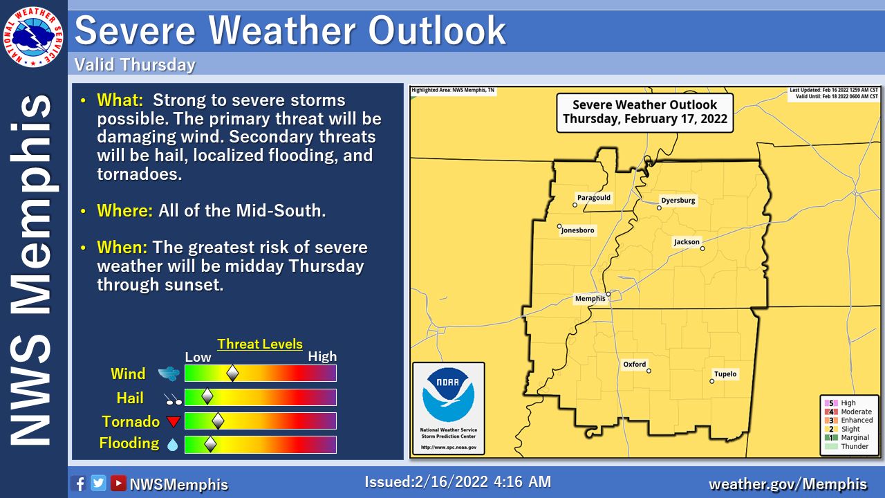
The National Weather Service issued a Wind Advisory for Lafayette County that runs today through 6 p.m. on Thursday. South winds 20 to 30 mph with gusts up to 50 mph are expected.
The high should reach about 72 degrees today before the cold front begins to move into the area this afternoon when winds will start to pick up to 15 to 20 mph.
Rain and thunderstorms could roll in tonight into early Thursday morning.
There is currently a slight chance for severe weather on Thursday with the worst of the storm predicted to occur around 4-5 p.m. tomorrow when wind gusts could reach 50 mph.
Rain will continue into Thursday evening with winds averaging 15 to 20 mph with gusts up to 35 mph.
The rain should taper off after about 6 p.m.
The cold front will cause the temperature to rapidly drop throughout the day on Thursday, reaching a high of 73 during the day and then hitting a low of 27 degrees overnight.
The clash of warm and cold air could cause isolated tornadoes.
The high for Friday is expected to be 46 with a low of 26 degrees.
There are no tornado or severe weather watches issued by NWS for Lafayette County as of this morning; however, that could change depending on the path of the storms. Check Hotty Toddy News on Facebook and Twitter for any updates as they become available.