
By Alyssa Schnugg
News editor
For the next three days in Lafayette County, it will feel a bit like spring is on the way.
Enjoy it while you can.
On Wednesday night, another cold front will be headed into north Mississippi, dropping temps back down and bringing the possibility of some strong storms and gusty winds.
According to the National Weather Service, today’s high is expected to hit 54 degrees under mostly sunny skies. The low tonight should be around 36 degrees.
Tuesday will be sunny with a high near 60 degrees and a low around 47 degrees overnight.
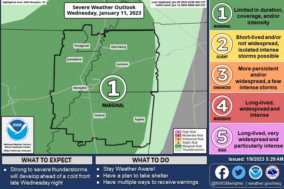
Wednesday’s high is expected to hit about 68 degrees. The day will start off cloudy until the sun breaks through for the rest of the afternoon. However, clouds return later Wednesday night as the cold front approaches.
The low expected for Wednesday night is 56 degrees. Showers and thunderstorms are likely Wednesday night before 3 a.m. Some could be severe. Winds will be around 5 to 10 mph with gusts up to 25 mph overnight.
The rain is expected to continue into Thursday morning. Thursday’s weather will be a little erratic — going from spring-like temps back to winter within a few hours. The temperature will hit about 68 degrees until around noon when it will begin to drop as the cold front heads into Lafayette County.
Winds could gust around 30 mph during the afternoon hours on Thursday.
Thursday night’s low is expected to be about 34 degrees.
Friday will be sunny but cold with a high near 45 degrees and a low that night of 27 degrees.
Saturday will be sunny with a high near 48 degrees and a low around 32.
Things begin to warm up a bit on Sunday with a high of 57 degrees under mostly sunny skies.
Hotty Toddy News will continue to monitor the weather outlook for Wednesday night and report any watches, warnings and advisories as they are reported by the National Weather Service.


