
By Alyssa Schnugg
News editor
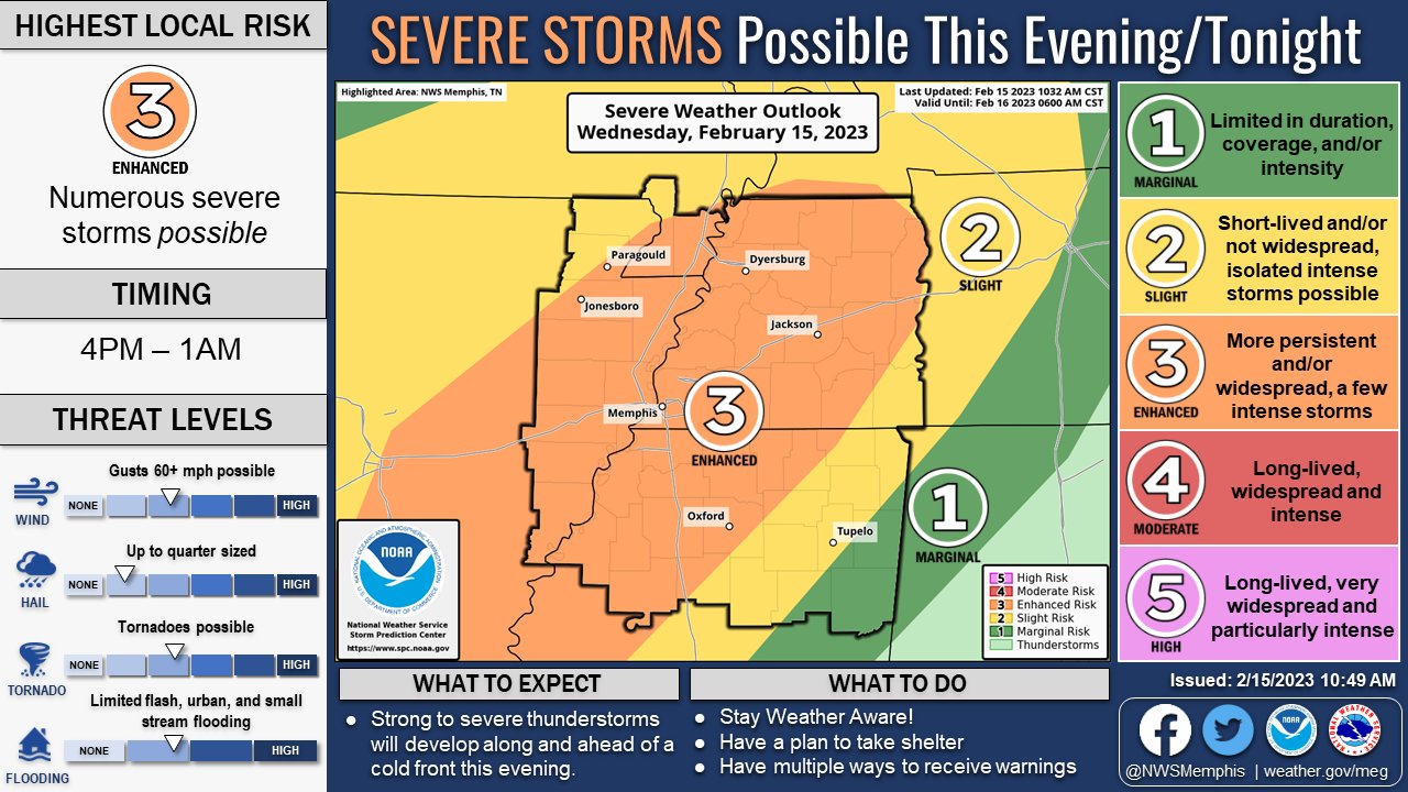
The National Weather Service has bumped up Lafayette County’s risk for severe storms tonight.
On a 1 to 5 scale for severe storms, Lafayette County is now rated a 3, or Enhanced Risk, according to the NWS.
Severe thunderstorms are expected tonight as an incoming cold front collides with the current warm air.
The highest risk tonight for severe storms, which could include wind gusts up to 35 mph, heavy rain and possible tornadoes, will be from 4 p.m. today until 1 a.m. Thursday.
However, the rain and thunderstorms are expected to continue overnight and into Thursday until about 7 p.m.
Some of the storms Thursday could also be severe.
The high today will reach around 73 degrees. Thursday’s high is expected to be around 67 degrees; however, the temperature will drop quickly Thursday afternoon – almost 30 degrees, to hit a low of about 32 degrees overnight into Friday morning.
Hotty Toddy News will announce any weather-related updates, watches or warnings on its website and Facebook and Twitter pages.


