
By Alyssa Schnugg
News editor
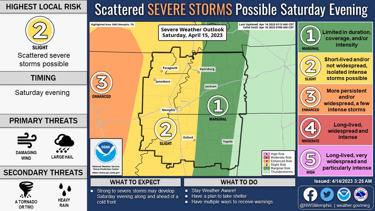
An upper-level trough and associated cold front will move into north Mississippi on Saturday bringing rain and possibly some strong to severe thunderstorms.
According to the National Weather Service, Oxford is currently listed as having a Slight Risk for severe weather Saturday night.
There is a 40 percent chance of rain after 10 a.m. on Saturday. In between showers, the sun will peek through at times. The high is expected to hit 79 degrees.
Later in the day and into the evening hours, the chance of storms increases to 70 percent. The front brings the potential for a few strong to severe thunderstorms with damaging winds as the primary threat.
The front will bring cooler temperatures and drier air for Sunday and Monday and moderate temperatures through the middle of next week.
The high on Sunday is expected to be 63 degrees under partly sunny skies. It will be breezy with winds around 15 to 20 mph with gusts as high as 30 mph. The low will be around 45 degrees under mostly clear skies.
Monday is expected to be 69 degrees with sunny skies.


