
By Alyssa Schnugg
News editor
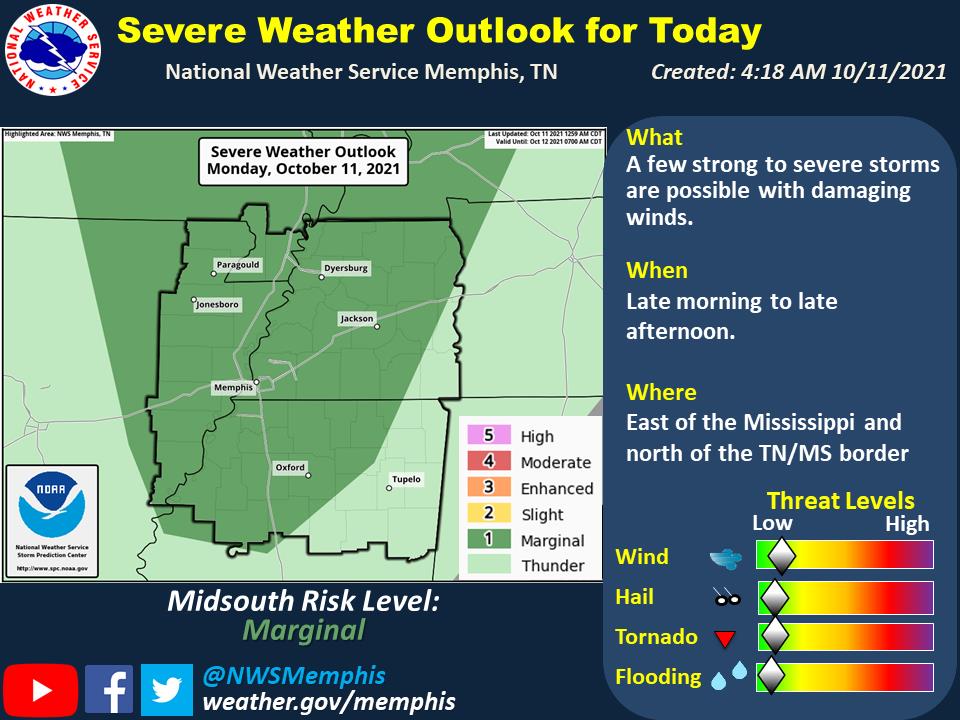
A cold front will push through the region today with scattered showers and a few thunderstorms, according to the National Weather Service.
A few strong to severe storms are possible from late morning until late afternoon with Lafayette County seeing the strongest storms from 4 to 7 p.m.
Lafayette County’s risk for severe weather is “marginal,” a 1 on a scale of 0-5, with 5 being the highest risk.
However, wind gusts could reach up to 25 mph during the storms which could knock down older trees and limbs, causing power outages.
The “cold front” will be more like a “cool” front as temperatures are expected to remain in the low to mid-80s throughout the week with lows in the mid to high-60s.
Little to no rain is expected through Thursday.
A stronger cold front is expected to move into the area starting on Friday that will drop temperatures by more than 15 degrees with the high on Saturday forecast to be near 68 and the low that night at 48 degrees.
There are no weather alerts currently issued for Lafayette County ahead of today’s expected storms. Check Hotty Toddy News social media sites (Facebook and Twitter) for any updates throughout the day.


