By Alyssa Schnugg
News editor
UPDATE: The NWS issued a Wind Advisory for Lafayette County from 7 a.m. to 7 p.m. Tuesday.
The National Weather Service has issued a Flood Watch for Lafayette County from 7 a.m. to 7 p.m. on Tuesday as an early-spring cold front heads into the area.
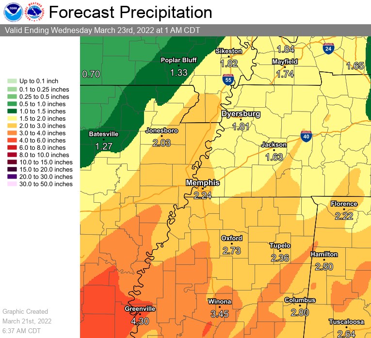
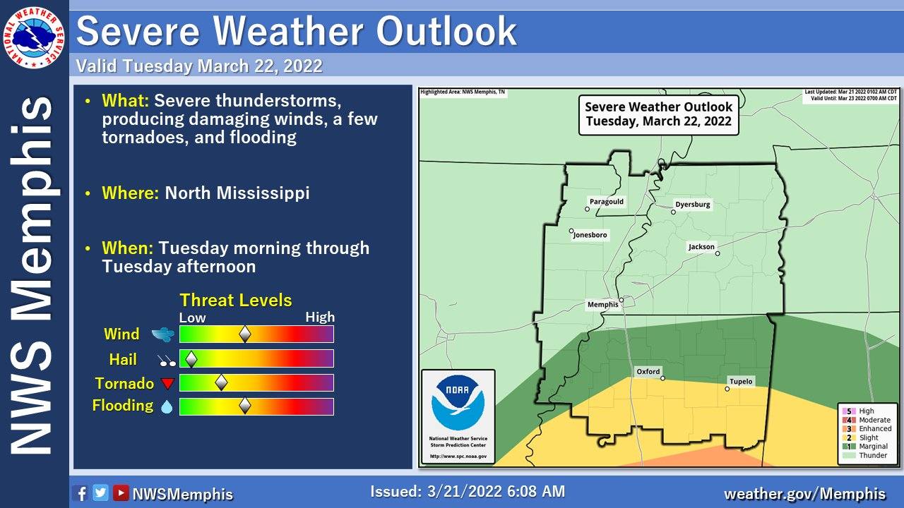
Lafayette County is currently under a “marginal to slight risk” of severe weather associated with the front; however, thunderstorms are expected to dump about 2-3 inches of rain.
The biggest threats associated with the severe weather for Oxford and Lafayette County are currently wind damage and flooding, according to the NWS in Memphis. Isolated tornadoes are possible.
The rain is expected to start around 3 to 4 a.m. Tuesday and continue throughout the day.
Stronger thunderstorms are expected after 7 a.m. with winds averaging about 10 to 15 mph with gusts as high as 25 mph.
Showers and possible thunderstorms are expected into Tuesday night when they will begin to taper off after midnight.
The minor cold front will drop average temperatures slightly over the next few days with high temps expected to be around 59 degrees on Wednesday and Thursday with lows around 39 degrees.