By Alyssa Schnugg
News editor
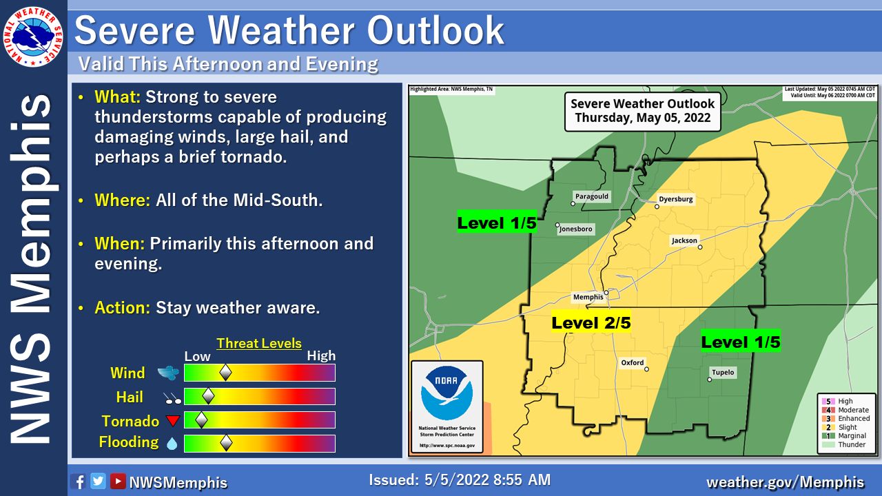
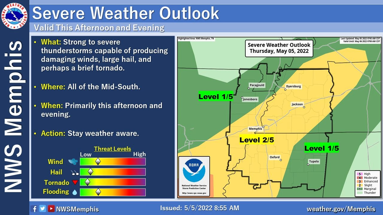
Lafayette County has a “slight” risk for severe thunderstorms later today.
According to the National Weather Service, a minor cold front is headed into the area bringing storms and cooler temperatures for a day or two.
While showers are possible this afternoon, the more serious storms are expected to arrive between 5 and 8 p.m.
Rain could continue throughout the night into early Friday morning.
However, the sun will return around 7 a.m., bringing in gusty winds of up to 25 mph under mostly clear skies and a high temperature of 76 degrees. The low is expected to be about 56 degrees.
Temperatures will remain in the high 70s/mid-50s on Saturday. However, a warm front will quickly get temperatures climbing starting on Sunday. The highs are expected to be in the 90s next week.