By Alyssa Schnugg
News editor
After a week of August-like temperatures across the Mid-South, a cold front moving into Lafayette County this weekend should cool things off for a few days.
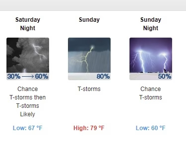
The front is expected to move into the area on Saturday night, bringing rain and the possibility of thunderstorms Saturday night into Sunday, according to the National Weather Service.
The chance for thunderstorms will be greatest after 1 a.m. on Sunday with an 80 percent chance of storms during the day. Locally heavy rainfall, hail and gusty winds will be the primary threats.
The high for Saturday is 91 degrees. On Sunday, that will drop to about 79 degrees.
Rain could continue into Monday with a 40 percent chance of thunderstorms mainly after 1 p.m. with a high of 77 degrees.
As of Friday morning, the extended forecast from the NWS shows chances of rain ranging between 30-40 percent each day throughout next week, keeping the highs next week in the upper-70s to low-80s and the low temperatures around the mid-60s at night.
No warnings or watches have been issued for this weekend’s weather as of this morning.
Hotty Toddy News will post any updates on its website and on Facebook and Twitter.