By Alyssa Schnugg
News editor
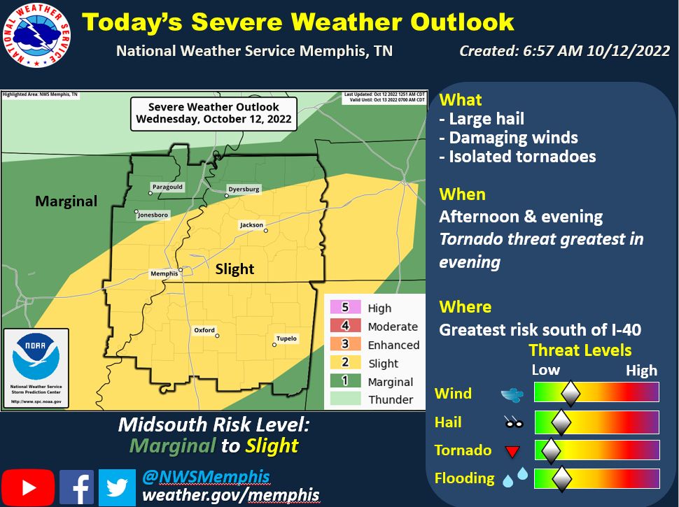
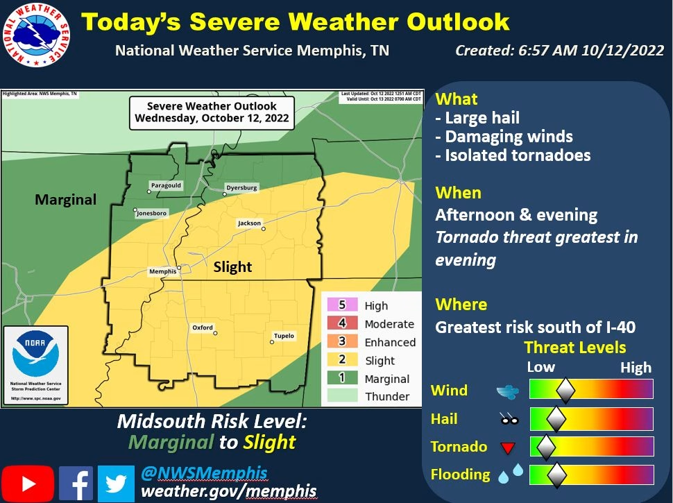
Oxford has a slight chance of severe weather later today as a cold front moves into the area.
According to the National Weather Service, storms are expected to roll in after 3 p.m. and continue into the evening.
A “slight” chance of severe weather is a 2 on the NWS’s severe weather 0-5 rating system with 0 being just rain and thunder and a 5 is a high risk for severe weather.
Oxford and Lafayette County could receive some severe thunderstorms that could produce hail and a possible isolated tornado.
The best chance for tornado activity will be later in the evening, according to the NWS.
The area could receive up to 1 inch of much-needed rain with the storms.
After the clouds clear overnight, Thursday will be sunny with a high of 72 degrees that will drop to 47 degrees overnight.