
By Alyssa Schnugg
News editor
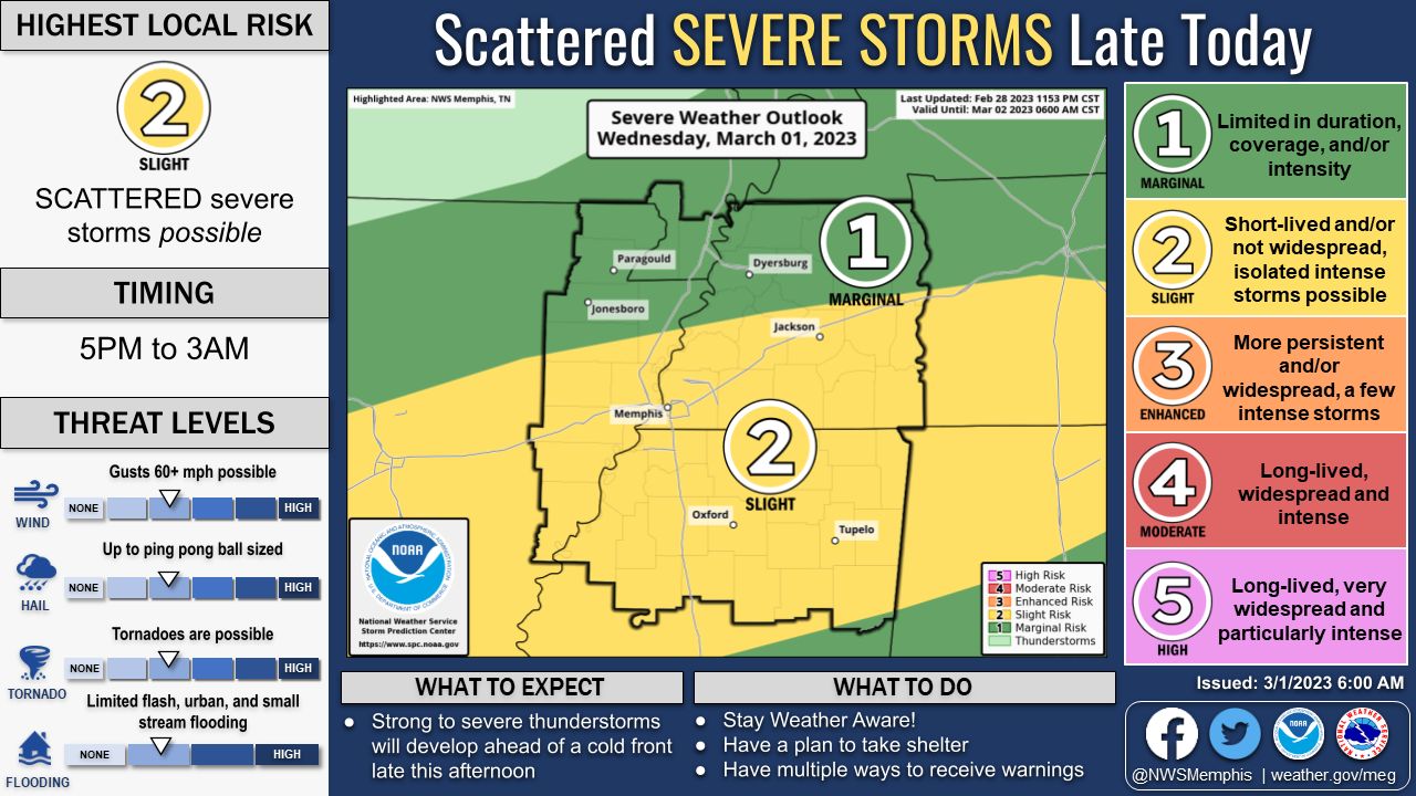
UPDATE: The NWS has updated Lafayette County to a 3, or Enhanced Risk, for severe weather today, Wednesday.
Lafayette County has a chance to get some severe thunderstorms later today and Thursday that could bring heavy rain and gusty winds.
There is currently a Flood Watch issued by the National Weather Service for Lafayette County from 3 p.m. today through 6 p.m. on Friday.
The NWS’s Severe Weather Risk rating system is a scale from 1 to 5 with 1 being little to no risk of any severe weather and 5 being a very high risk for severe weather.
For today, Lafayette County is at a slight risk, or a 2, for severe storms. The biggest chance for severe weather today will be tonight after 5 p.m.
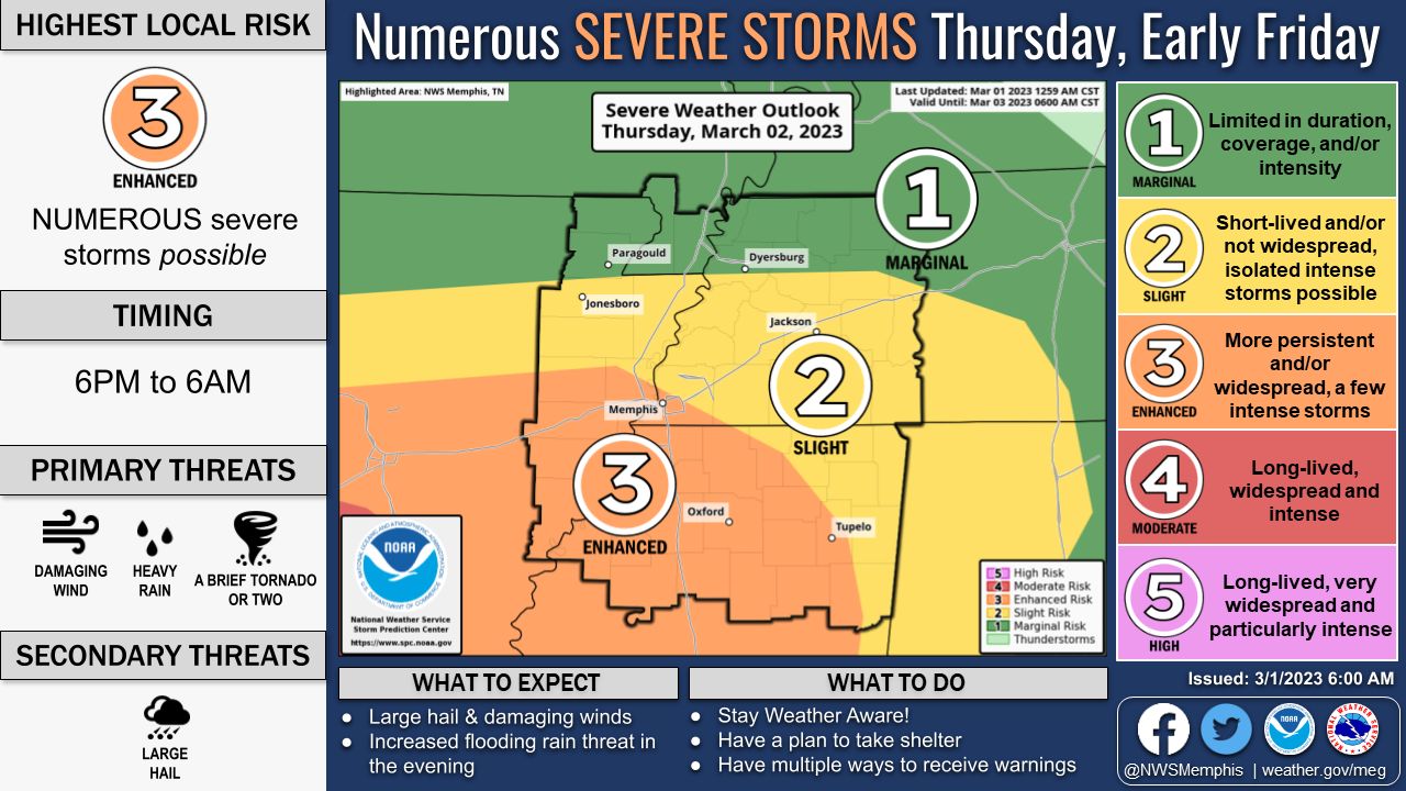
On Thursday, Lafayette County has an Enhanced Risk, or a 3, for severe weather. Rain is expected throughout most of the day and into the night with the greatest chance for severe storms occurring after 6 p.m. on Thursday.
The wind is expected to pick up Thursday night as a minor cold front pushed into the area with winds of about 15 to 25 mph with gusts as high as 35 mph.
The rain and gusty winds are expected to continue overnight into Friday morning when there is a 40 percent chance of showers and thunderstorms before noon. Wind gusts could reach up to 45 mph on Friday.


