
By Alyssa Schnugg
News editor
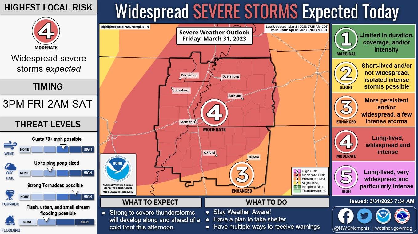
Lafayette County’s chance to see severe weather later today has been bumped from a 3 to a 4 on the National Weather Service’s Severe Weather Risk 1 to 5 scale, with 1 being the lowest chance and 5 being the highest.
A 4, or Moderate Risk, means storms could be long-lasting and intense. The greatest threat currently is tornadoes and high, damaging winds. Secondary threats are hail and flooding.
According to the NWS, the heaviest of the storms are expected in Lafayette County after 7 p.m. but our area could see some strong thunderstorms roll in earlier and storms could last until midnight.
Watch a video from the NWS about tonight's storm system by clicking here: https://www.facebook.com/NWSMemphis/videos/769717251452739
There is currently a Wind Advisory in place through 1 a.m. Saturday. Gusts of up to 40 mph are possible later today as the front moves into the area.
Tonight’s storms could produce some heavy rainfall in some areas; however, the amount of rain expected is less than last week’s storm system that caused flooding. That system was responsible for several tornadoes in Mississippi that claimed the lives of 25 people in Amory, Rolling Fork, Silver City and Winona.
Visit CodeRed (Lafayette or Oxford residents) or Nixle (city of Oxford residents) to sign up for weather and emergency notifications.


