

By Alyssa Schnugg
News editor
Fall may finally be arriving in Oxford today.
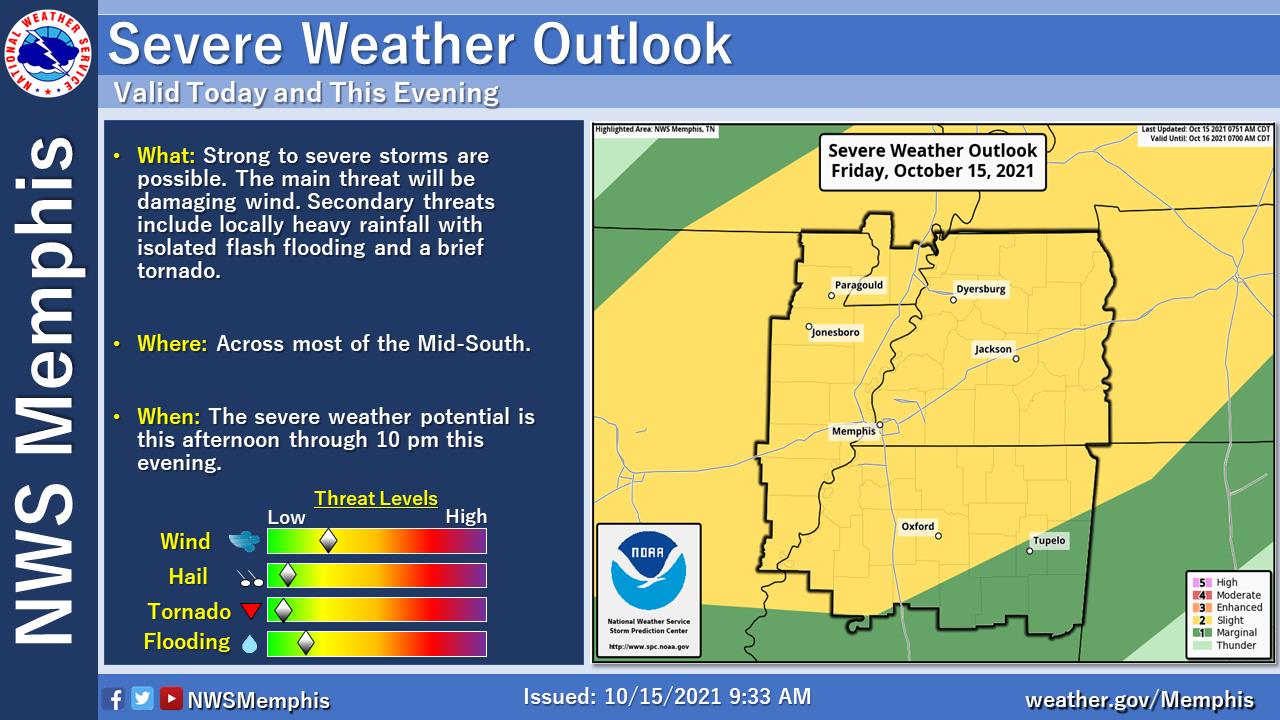
A cold front is pushing through the Mid-South later today and Lafayette County has a slight risk, or 2 on a 0-5 to scale, of severe weather.
Some strong or even severe thunderstorms are possible this afternoon and into the evening hours.
Damaging wind is the main threat; however, National Weather Service forecasters say an isolated tornado could occur.
Localized heavy rainfall and isolated flash flooding are also possible threats, according to the NWS.
The front will cause temperatures to drop to more fall-like weather. Today’s high could reach 82; however, after the storm passes, the low tonight is expected to be 51 with Saturday’s high a cool 68 degrees. The low for Saturday night could hit 44 degrees.
The high temperature will slowly increase throughout the week but stay 69-73 throughout the next several days at least with lows in the mid-to-upper-40s.
No rain is in the forecast through Tuesday.
No watches or warnings have been issued by the NWS for Lafayette County as of this morning. There are no weather alerts currently issued for Lafayette County ahead of today’s expected storms. Check Hotty Toddy News social media sites (Facebook and Twitter) for any updates throughout the day.


